Colsterdale Coal – Two Dales of Industry
NEXT WALK: SATURDAY 7TH JUNE
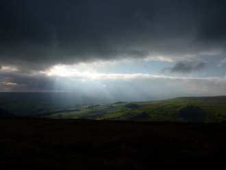
This walk combines the industrial heritage and beautiful views of two remote valleys on the edge of the Yorkshire Dales.
From Gollinglith near Masham we first explore the length of Colsterdale, following the century-old Colsterdale Coal Road to the head of the valley and the peak of South Haw on the boundary between Colsterdale and Nidderdale. As the name ‘Coal Road’ suggests, we see evidence of a once-thriving mining area throughout the dale. We’ll find out more about turn-of-the-century mining practices and the lives of its workers. On reaching South Haw, we traverse the tops into beautiful Nidderdale – and more evidence of the Colsterdale coal seams running all the way from one dale to another! The climax of our walk is the magnificent view onto Scar House Reservoir – hiding industrial secrets of its own - from Nidderdale’s own coal road. Finally we cross wild moorland, farmland, woodland and babbling brooks back to our starting point at picturesque Gollinglith.
11.5 miles (18km) with 1700 feet (530m) of ascent & descent
Ascents and descents are generally steady but with one or two steeper woodland and field sections.
This route includes a variety of terrain including muddy or rough sections so walking boots should be worn. We cross remote and exposed moorland where the weather may be different to that in the valleys so waterproofs and spare warm clothing, hats and gloves should be carried at all times of year.
JOIN US
Next walk: Saturday 7th June
*Special introductory offer: £10 per person (£8 under 18) - usually £15!*
Just turn up! 10am at Gollinglith car park, near Masham, HG4 4LL
Waterproofs and spare warm layers, hat and gloves should be carried at all times of year as the weather can be different on the remote moors. Please also bring sturdy footwear (likely to be boggy!), picnic & water. Under 18's must be accompanied by an adult.
