Great Whernside: the Summit of Nidderdale
Summits, reservoirs, wild moorland and murderous tales! What more could you want?
Great Whernside is one of the highest peaks in the Dales at 704m above sea level. It’s a popular walk from Kettlewell in Wharfedale, but we think the opposite approach, from Scar House Reservoir in Nidderdale, is even more special.
After first admiring the mighty Scar House Dam and finding out how it was built in such a remote area, our route takes us above Scar House Reservoir to the ruins of Lodge, an ancient hamlet with a grisly secret…
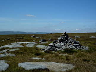
From here we climb steadily up the hillside above Angram Reservoir and onto Great Whernside’s lofty summit ridge with views across the Dales as far as the Three Peaks, and back across our reservoirs into Nidderdale and beyond.
We then leave the path completely and make our own way down open moorland to the beautifully remote Angram Reservoir, before returning to our starting point at Scar where refreshments are sometimes available to purchase.
11 miles (18km) with 1550 feet (475m) of ascent and descent
This route takes in varied terrain including defined but uneven tracks and boggy open moorland so appropriate footwear must be worn; this is a fairly remote and exposed area so waterproofs and spare warm clothing should be carried at all times.
Great Whernside is one of the highest peaks in the Dales at 704m above sea level. It’s a popular walk from Kettlewell in Wharfedale, but we think the opposite approach, from Scar House Reservoir in Nidderdale, is even more special.
After first admiring the mighty Scar House Dam and finding out how it was built in such a remote area, our route takes us above Scar House Reservoir to the ruins of Lodge, an ancient hamlet with a grisly secret…
From here we climb steadily up the hillside above Angram Reservoir and onto Great Whernside’s lofty summit ridge with views across the Dales as far as the Three Peaks, and back across our reservoirs into Nidderdale and beyond.
We then leave the path completely and make our own way down open moorland to the beautifully remote Angram Reservoir, before returning to our starting point at Scar where refreshments are sometimes available to purchase.
11 miles (18km) with 1550 feet (475m) of ascent and descent
This route takes in varied terrain including defined but uneven tracks and boggy open moorland so appropriate footwear must be worn; this is a fairly remote and exposed area so waterproofs and spare warm clothing should be carried at all times.
